

Fly the boundary and obstacles once with a DJI RTK drone, mark points at centimeter accuracy, and export a map your spray drone can fly immediately. No photogrammetry, no walking the boundary, no office software — faster and cheaper than a photogrammetry mapping flight.
The fastest way to get a field ready for autonomous spraying — using the drone you already fly.
Skip the handheld RTK rover. Fly the perimeter once from the controller you already use, and mark every corner and obstacle in minutes instead of walking the field on foot.
See poles, trees and ditches live in the flight camera and mark them on the spot — more affordable and faster than photogrammetry, with no orthomosaic to wait on, and far easier to catch the terrain and obstacles photogrammetry struggles to resolve, like thin wires, poles under canopy, or ground hidden in shadow.
You don't need to haul your agriculture drone out just to map a field. A small DJI RTK drone flies faster, holds a steadier hover for centimeter-accurate points, and maneuvers tighter around poles and tree lines — all without risking a heavy spray drone near obstacles at low altitude. Map with the small drone, then send the spray drone out only once the field is ready to work.
Vekta Fields doesn't replace survey-grade photogrammetry — it replaces the extra mapping flight most spray operations don't need.
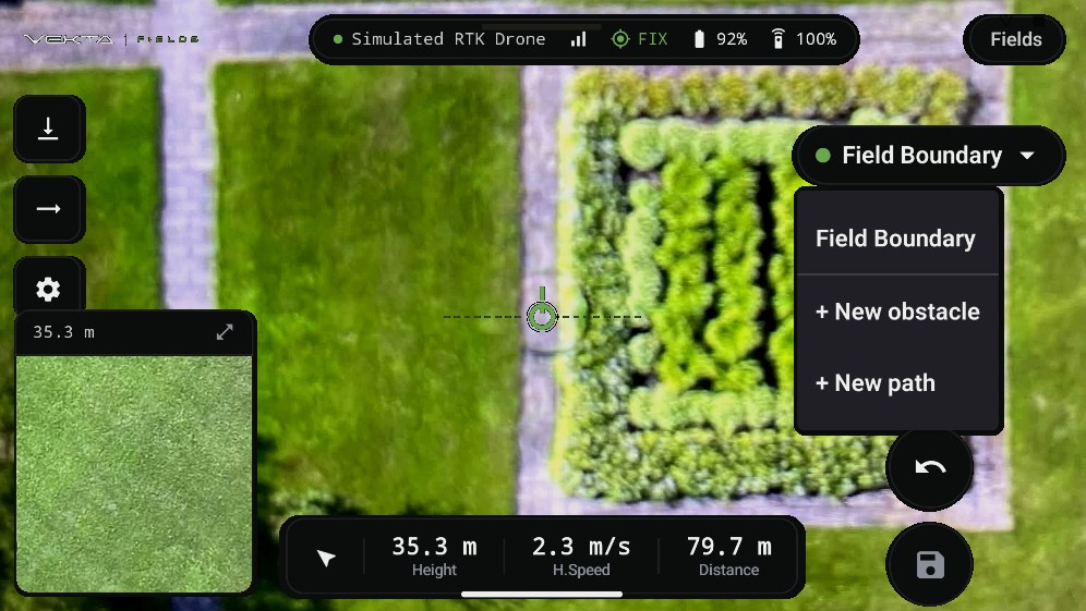
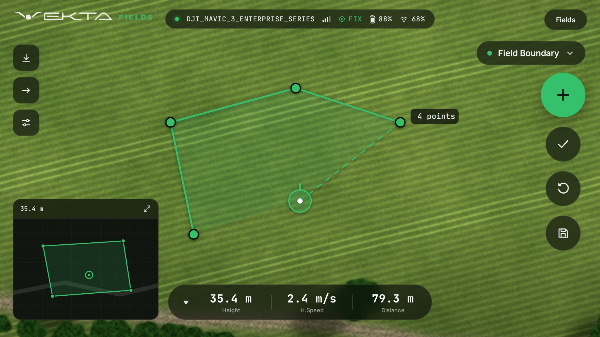
Three steps in the field, on the controller you already fly with. Screens below are from the app running on a DJI RC Pro controller.
Fly your DJI RTK drone along the field's edge and tap to drop a point at each corner. The live camera feed, RTK fix status and height stay in view the whole time — no separate mapping app, no second flight.
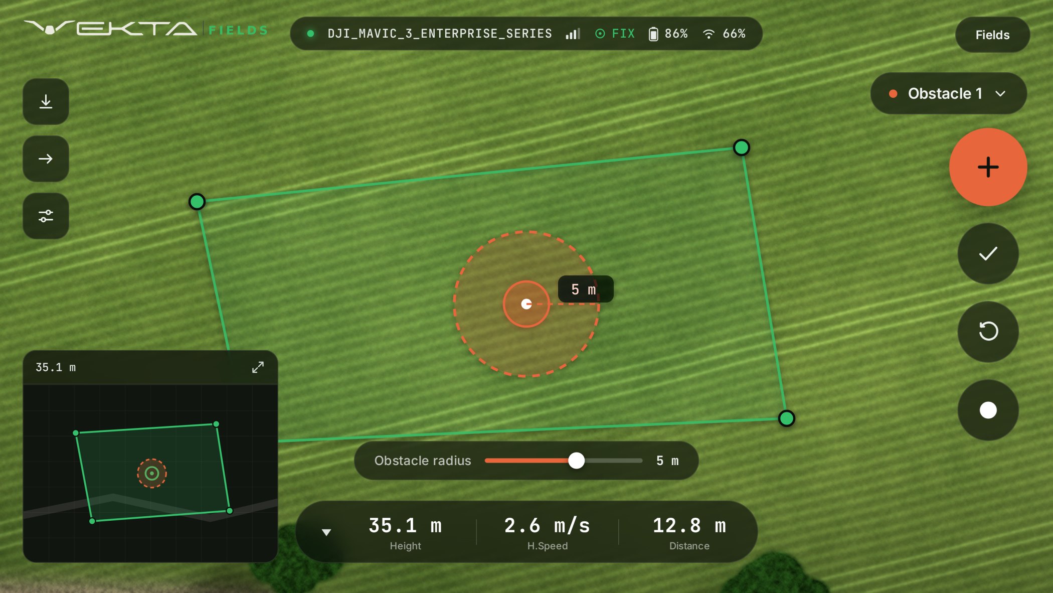
Switch modes without leaving the flight view. Fly over a pole, tree or ditch, mark it, and set a clearance radius so your spray drone knows how wide to give it. Every point is logged at centimeter-level RTK precision.
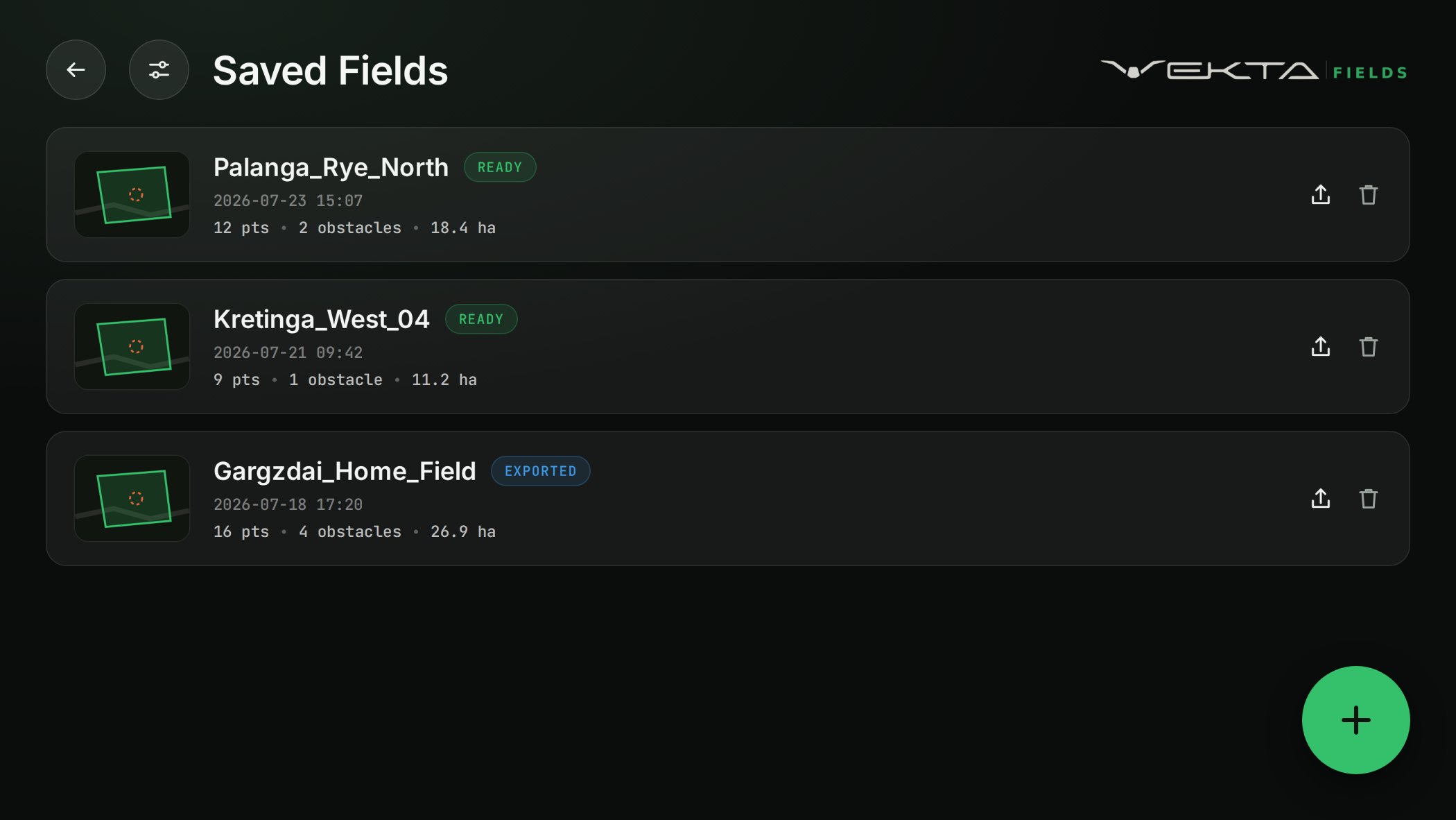
Saved fields carry their point count, obstacles and computed area. Share out a KML or Shapefile and load it straight into your spray drone — the field is ready to fly minutes after you land.
For contractors, farmers, and spray-drone operators who need accurate field boundaries and obstacle maps for autonomous spraying.
RTK-grade boundary and obstacle marking, no survey crew required.
Mark points live in flight — skip stitching, processing and orthomosaics entirely.
Prepare a field for spraying without office processing.
KML and Shapefile output, compatible with spray drone software.
DJI RTK-enabled drones
KML · SHP
±2cm RTK
Vekta Fields is built on the DJI Mobile SDK. Whether it runs on a given aircraft depends on two separate things.
The aircraft and controller expose the DJI SDK capabilities third-party apps like Vekta Fields need — live camera feed, RTK positioning data, flight control. This is defined by DJI, not by Vekta.
The aircraft has actually been implemented and tested in Vekta Fields. Not every SDK-capable aircraft has been built and verified yet — supported aircraft are continuously expanding.
These are the DJI enterprise aircraft that DJI lists with Mobile SDK support, taken from DJI's official SDK compatibility documentation — not a guarantee that every listed aircraft is implemented in Vekta Fields today. Centimetre accuracy needs an RTK fix, from built-in RTK or DJI's add-on RTK module. Consumer drones with SDK support are covered by Vekta Survey at GPS accuracy. Get in touch to confirm your specific aircraft.
Once your field is mapped, export the boundary and obstacle data and continue directly into your agricultural drone workflow.
Vekta Fields exports field data for XAG agricultural drone workflows.
Vekta Fields exports field data for DJI Agras agricultural drone workflows.
Vekta Fields exports field data for TopXGun agricultural drone workflows.
Need the full walkthrough? Download the step-by-step drone import guide (PDF) covering XAG, DJI Pilot 2, and TopXGun.